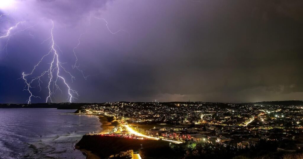
A sprawling storm system crossing the U.S. on Friday overturned semitrucks on highways and fanned wildfires in Texas and Oklahoma, where officials called for evacuations in at least one town. Tornado threats loomed for the Mississippi Valley into the night and the Deep South on Saturday.
The National Weather Service predicted extreme weather across a vast swath of the U.S. with a population exceeding 100 million people. Powerful winds gusting up to 80 mph were forecast from the Canadian border to Texas.
The storm system is expected to bring rain to California’s central coast Friday, a day after the National Weather Service confirmed a tornado touched down in East Los Angeles as a large, strong storm system caused flooding in the area.
Forecasters say the severe storm threat will continue into the weekend, with a high chance of tornadoes and damaging winds Saturday in Mississippi and Alabama. Heavy rain could bring flash flooding to some parts of the East Coast on Sunday.
Experts say it’s not unusual to see such weather extremes in March, with storm systems producing heavy snow and blizzards on the cold side and severe thunderstorms and tornadoes on the warm side.
“What’s unique about this one is its large size and intensity,” Bill Bunting of the weather service’s Storm Prediction Center told the Associated Press. “And so what that is doing is producing really substantial impacts over a very large area.”
Tornadoes likely amid storm outbreak
The Storm Prediction Center said fast-moving storms could spawn tornadoes and hail up to baseball-sized on Friday. But the greatest threat would come from straight-line winds near or exceeding hurricane force, with some gusts possibly reaching 100 mph (160 kph).
Forecasters said areas most at risk were in eastern Missouri, much of Illinois and portions of Iowa, Kentucky, Tennessee, Arkansas and Mississippi. About 47 million people faced an enhanced to moderate severe storm threat from Madison, Wisconsin, to Birmingham, Alabama.
Forecasters grew increasingly worried that intense thunderstorms further south would likely bring an even greater tornado threat.
The National Weather Service’s Storm Prediction Center issued a level 5 risk, the highest, for severe storms for the Gulf states on Saturday and into Sunday, predicting a tornado outbreak across the central Gulf Coast states and Deep South into the Tennessee Valley.
“We fear we could see intense, destructive tornadoes over the South tomorrow,” Bunting told the Associated Press.
Alabama Gov. Kay Ivey declared a preemptive state of emergency Friday, urging people across the state to be vigilant overnight and into the weekend.
Blizzards expected in Northern Plains
Forecasters warned that heavy snow whipped by powerful winds are likely to make travel treacherous in parts of the Rockies and Northern Plains. Blizzard conditions were possible in the Dakotas and Minnesota.
Winter storm warnings issued Thursday lingered into Friday morning in mountainous regions of Arizona and Utah, where more than a foot of snowfall was possible. Forecasters warned of poor visibility and icy road conditions. Snow in northern Arizona shut down some stretches of Interstate 40.
The winter blast continued after snowfall of up to 3 feet blanketed the Sierra Nevada earlier in the week.
Dry, gusty conditions bring “extreme” threat of wildfires
Warm, dry weather and sustained winds of up to 45 mph brought what the weather service called “near historic” conditions for sparking wildfires Friday to the Southern Plains and parts of the Southwest. Wind gusts exceeding 80 mph (128 kph) were possible.
Forecasters also warned about an extreme risk of fires in parts of northern Texas, much of Oklahoma and southeast Kansas. A broader area where the fire threat was designated as critical stretched from eastern New Mexico into Texas and north to a portion of southern Iowa.
The weather service said a potential for dry thunderstorms in parts of Kansas, Oklahoma, Missouri and Arkansas carry the added risk of fires being started by lightning with minimal rainfall to impede them.
Missouri Gov. Mike Kehoe declared a state of emergency Friday in anticipation of the severe weather expected to hit the state, urging residents “to stay alert, monitor weather forecasts, and follow official warnings.”
More than half of Texas’ 245 counties had burn bans in place because of the dangerous fire conditions. The weather service in Lubbock posted a video Friday morning on X of wind whipping thick dust across the road as one of its employees drove to work.
“This is likely to be the worst dust storm so far this year,” said Randall Hergert, a lead forecaster with the weather service in Albuquerque, New Mexico.