Satellite images are providing a clearer picture of the devastation brought by the deadly flooding in Central Texas over the July Fourth weekend.
More than 100 people were killed and over 160 remained missing as of Tuesday evening, officials said.
Heavy rain in the region known as Texas Hill Country caused the Guadalupe River to rise rapidly on Friday. Kerr County, whose largest city of Kerrville is located about 100 miles west of Austin and 65 miles northwest of San Antonio, was hit the hardest, accounting for the majority of deaths.
Below are satellite photos showing before and after images of areas hit by the flooding:
Camp Mystic
Satellite image ©2025 Maxar Technologies 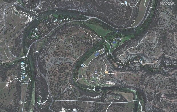
Satellite image ©2025 Maxar Technologies 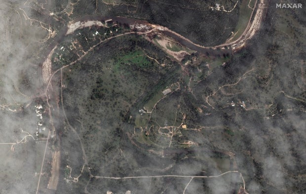
At least 27 victims were campers or counselors at Camp Mystic, which describes itself as a private Christian summer camp for girls located on the banks of the Guadalupe River.
Satellite image ©2025 Maxar Technologies 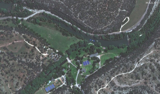
Satellite image ©2025 Maxar Technologies 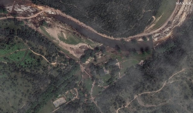
Satellite image ©2025 Maxar Technologies 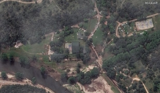
Ingram Dam
The Ingram Dam is located in Ingram, Texas, along the Guadalupe River, just to the west of Kerrville. Satellite imagery shows the aftermath of the flooding in the area of the dam.
Satellite image ©2025 Maxar Technologies 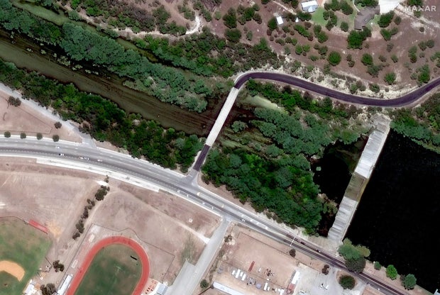
Satellite image ©2025 Maxar Technologies 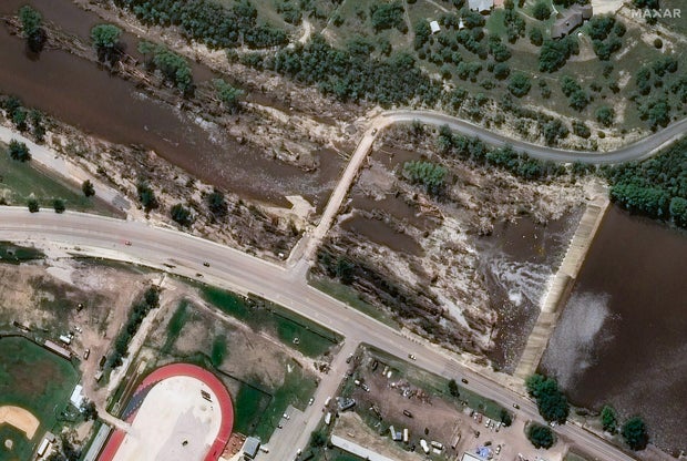
Flooding downs trees
Satellite image ©2025 Maxar Technologies 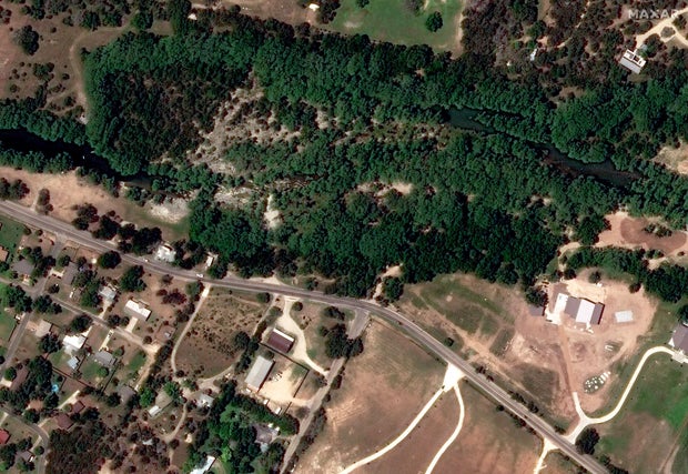
Satellite image ©2025 Maxar Technologies 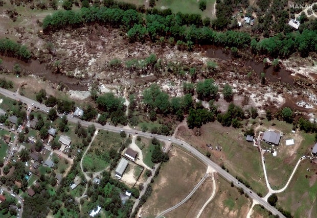
Debris left behind after flooding
Satellite image ©2025 Maxar Technologies 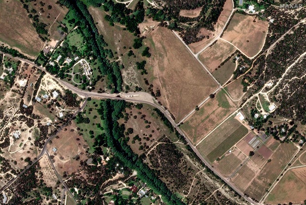
Satellite image ©2025 Maxar Technologies 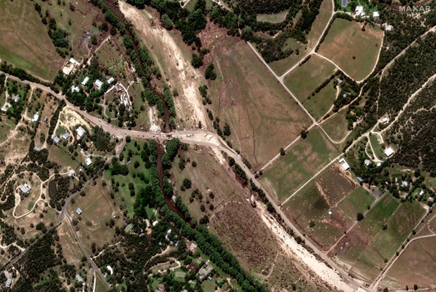
Emergency response vehicles
Satellite images also showed emergency vehicles responding to the aftermath of the flooding.
Satellite image ©2025 Maxar Technologies 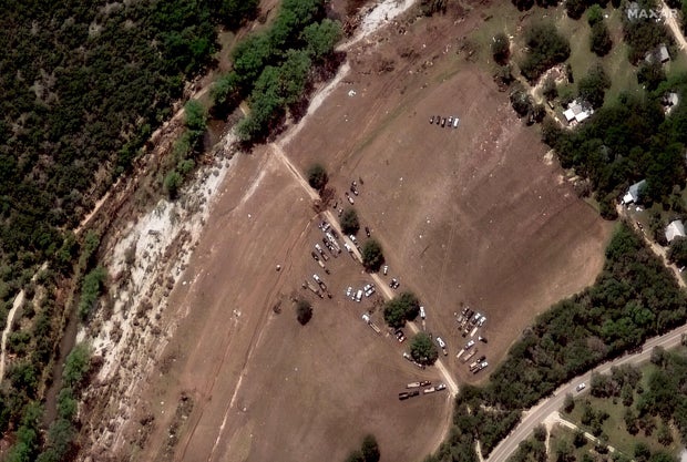
Satellite image ©2025 Maxar Technologies